|
June 10, 2015
|
|
- - - - - - - - - - - - - -
|
 |
| - - - - - - - - - - - - - - |
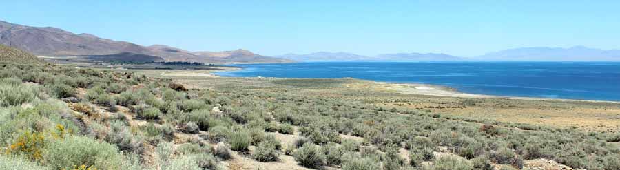
| Looking north... with the small town of Sutcliff in the darkened area left of center. I did drive there with the intention of stopping at the ranger station to inquire about a road that showed on a map I had... a road that would take me north and west so I wouldn't have to backtrack south from where I had come. The ranger station was closed, however. So I asked a young tattoo'd lady, who was switching out nearby portable toilets from a flatbed truck, about the road. "Yeah, it goes through, but it's dirt most of the way and subject to washout in some of the steeper sections." I thanked her and decided to head back down Highway 445. |
| _ |
| Pyramid Lake Map| 1 | 2 | 3 | 4 | 5 | 6 | 7 | 8 | 9 | 10 |
| Log entries: |
| June 8/9, Lake Tahoe | 10 Pyramid Lake | 11 Lake Almanor | 12 Mt Lassen / Burney Falls | 13 Mt Shasta | 14/15 Crater Lake |
| ______ |
| Travelogue Home Page| BunceMan.com |